

Table of Contents
Arno (Italy River)
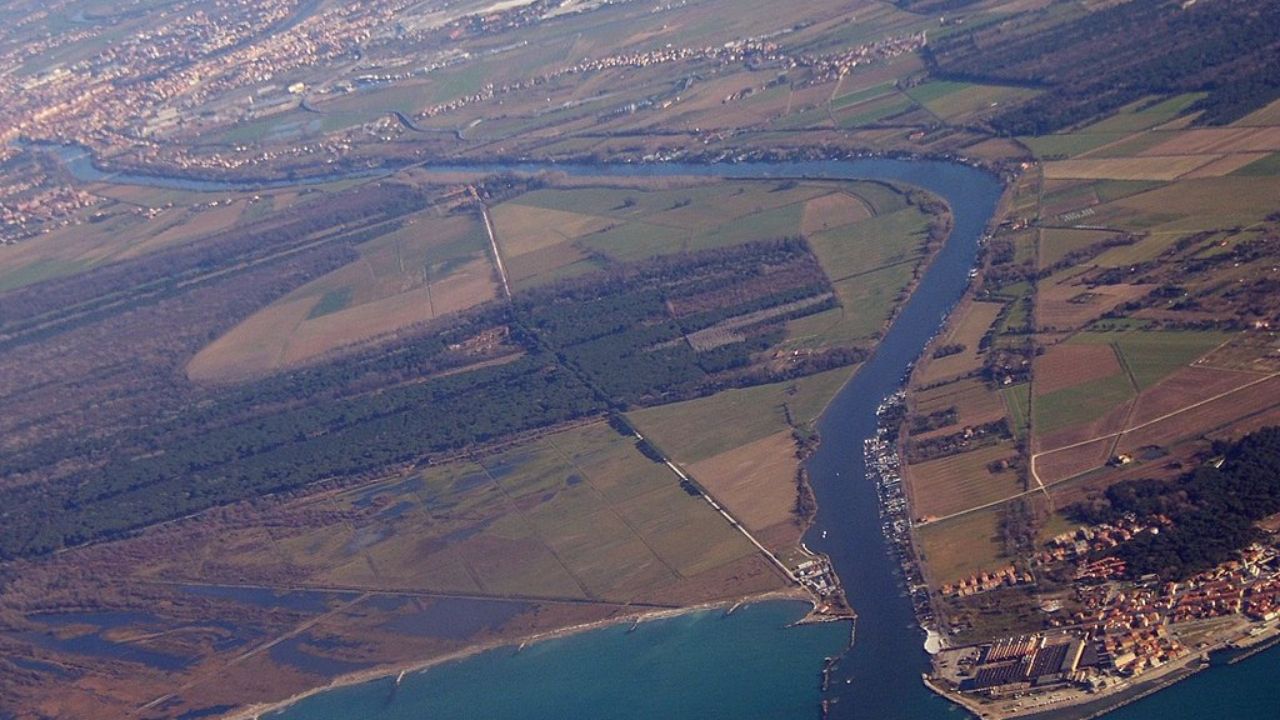
The Arno River, a vital waterway in central Italy, meanders through the picturesque region of Tuscany, making it a significant geographical and historical landmark. Originating from the Apennine Mountains’ Monte Falterona, the Arno flows south before turning west, threading its way through some of Italy’s most renowned cities, including Florence, Empoli, and Pisa. Its journey ends in the Ligurian Sea at Marina di Pisa, making it the largest river in the region with a length of 241 kilometers (150 miles).
The Arno River’s path is marked by its diverse and scenic surroundings, from the Casentino forests to the urban landscapes of Florence. This river is not only a natural resource but also a historical witness, having been central to Florence’s growth and development. The famed Ponte Vecchio and the Santa Trinita bridge span its waters, showcasing its integration into the city’s architectural heritage.
Historically, the Arno has been both a blessing and a bane. Its frequent flooding, most notably the devastating flood of 1966, has had a profound impact on the communities along its banks. The 1966 flood caused significant damage, leading to the loss of life and the destruction of invaluable cultural treasures. This disaster highlighted the need for improved flood management and conservation efforts.
Ecologically, the Arno has faced challenges due to the introduction of non-native species, which have altered its aquatic ecosystem. Despite these challenges, the river remains crucial for drinking water, irrigation, and other vital functions. The Arno’s fluctuating flow and the ongoing efforts to manage its water resources reflect its complex relationship with both the environment and human activities.
Marina di Pisa
| Arno (Italy River) | |
| Marina di Pisa | |
| Country | Italy |
| Region | Tuscany |
| Source | Monte Falterona |
| Elevation | 1,385 m (4,544 ft) |
| Mouth | Tyrrhenian Sea |
| Location | Marina di Pisa |
| Coordinates | 43.6802°N 10.2774°E |
| Length | 241 km (150 mi) |
| Basin size | 8,228 km2 (3,177 sq mi) |
| Discharge | 110 m3/s (3,900 cu ft/s) (at the mouth) |
Source and Route
The Arno originates on Monte Falterona in the Casentino area of the Apennines. It initially flows southward, then turns west near Arezzo, passing through Florence, Empoli, and Pisa before emptying into the Ligurian Sea at Marina di Pisa. The river spans 241 kilometers (150 miles) and is the largest in the region.
Key tributaries include the Sieve (60 km), Bisenzio (49 km), Ombrone Pistoiese (47 km), Era, Elsa, Pesa, and Pescia. The drainage basin covers over 8,200 square kilometers (3,200 sq mi), encompassing several subbasins:
- Casentino (Upper Arno)
- Val di Chiana (historically marshy, drained in the 18th century)
- Upper Valdarno (between Pratomagno massif and Siena hills)
- Sieve basin (flows into Arno before Florence)
- Middle Valdarno (includes Florence, Sesto Fiorentino, Prato, and Pistoia)
- Lower Valdarno (valley of tributaries Pesa, Elsa, and Era)
The river’s discharge varies significantly, from 6 cubic meters per second (210 cu ft/s) to over 2,000 cubic meters per second (71,000 cu ft/s). The mouth of the Arno, once near Pisa, is now several kilometers westward.
Historical Significance and Flooding
In Florence, the Arno flows beneath the Ponte Vecchio and the Santa Trinita bridge. The river has historically caused severe flooding, most notably in 1966, when the embankments collapsed, killing at least 40 people and damaging numerous works of art and rare books. This disaster prompted advancements in conservation techniques, though many works still await restoration.

Infrastructure and Flow Management
Before reaching Pisa, the Arno intersects with the Imperial Canal at La Botte. This canal, running under the Arno, drains the former Lago di Bientina, Tuscany’s largest lake before reclamation. The river’s flow is highly irregular, sometimes described as torrent-like. Flow rates at the Apennine exit can vary between 0.56 and 4,100 cubic meters per second (20 to 144,790 cu ft/s). Recent dams upstream of Florence have mitigated this issue.
Ecological Impact
The Arno has been significantly impacted by non-native species. Over 90% of fish species and 70% of macroinvertebrate species around Florence are alien, including the European catfish, channel catfish, Crucian carp, common bleak, topmouth gudgeon, New Zealand mud snail, and killer shrimp. The mud crab has also been found near Pisa.
Human Uses and Environmental Concerns
The Arno basin provides drinking water, irrigation, and firefighting resources. It also supports biodiversity, fisheries, and cultural value. However, there are concerns about flooding jeopardizing these services. Around 9% of wastewater treatment plants, 10% of waste sites, and 4.5% of contaminated sites in the area are at high risk of flooding, potentially causing pollution hotspots.
Etymology
The name “Arno” comes from the Latin “Arnus” (Pliny, Natural History 3.50). Philologist Hans Krahe linked this toponym to a paleo-European root *Ar-n-, derived from the Proto-Indo-European root *er-, meaning “flow, move”.


